General

By the end of this module, you will be able to:
Below is the study guide for this module. Take note that the content is the same as the course guide, but just contains the study materials related to module 1.
By the end of this unit, you should be able to:
By the end of this unit, you will be able to:
By the end of this unit, you should be able to:
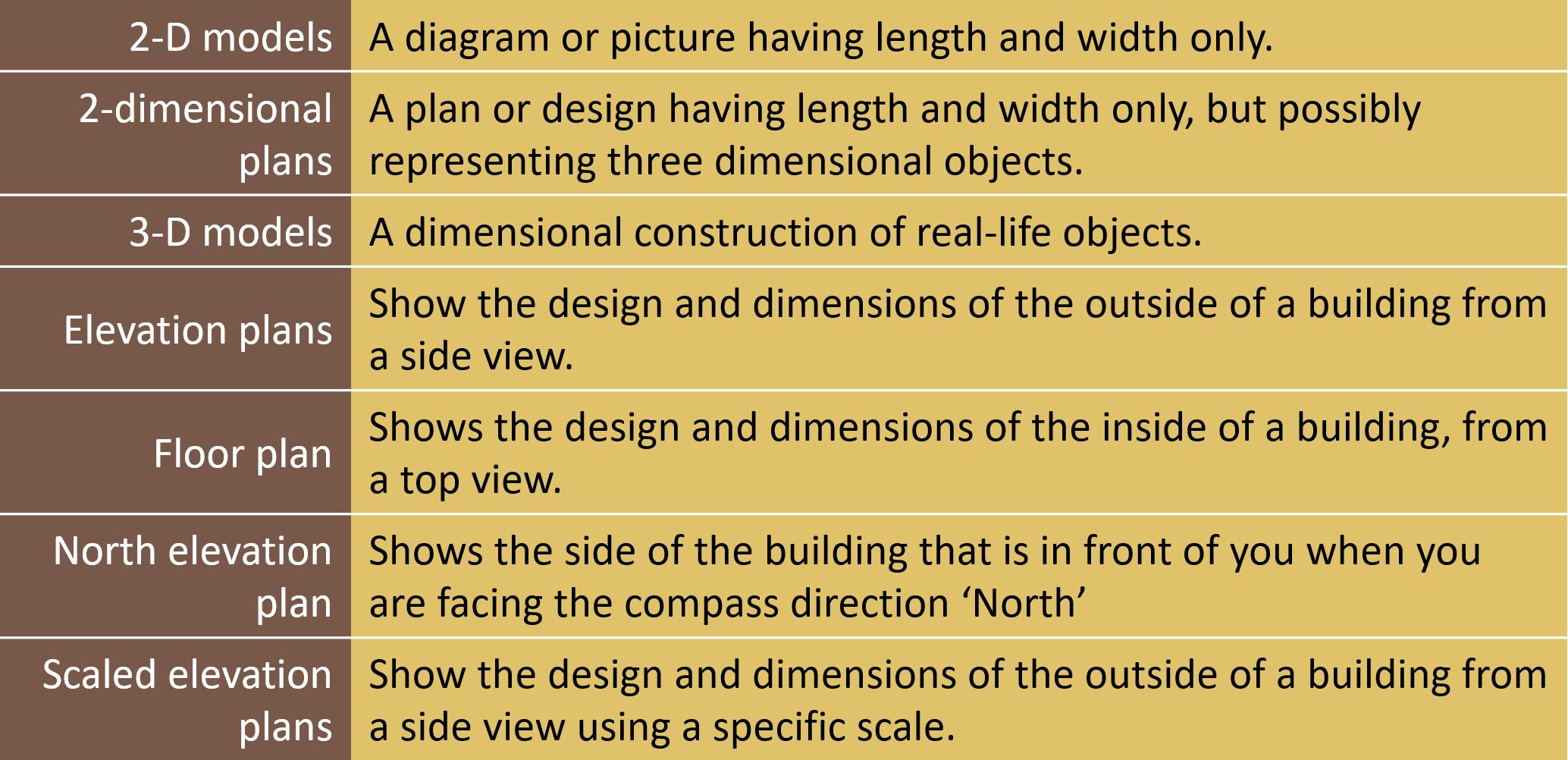
In this module,
you worked with two types of scales viz. number and bar scales, you calculated
the actual length and distance when plan measurements are known and worked with, and interpreted, elevation plans or different views of buildings.
In
this module, learners need more practice on questions involving general
direction questions and questions on a given set of directions. You should note that when a scale is given,
there is every chance that some actual
measurement will be done.
Therefore, learners should be afforded the opportunity to use their rulers in
class to measure classroom items (books, pens, pencils, etc.) on a regular basis.